Esta web utiliza cookies propias y de terceros que nos permiten optimizar tu experiencia en el sitio web, evaluar su rendimiento, generar estadísticas de uso y mejorar y añadir nuevas funcionalidades. Mediante el análisis de tus hábitos de navegación podemos mostrar contenidos más relevantes y medir las interacciones con la web.
Puede obtener más información aquí.
Una cookie es un fichero que se descarga en tu ordenador al acceder a determinadas páginas web.Las cookies permiten a una página web, entre otras cosas, almacenar y recuperar información sobre los hábitos de navegación de un usuario o de su equipo, gestionar el acceso de usuarios a zonas restringidas de la web, etc.Tipo de cookies utiliza esta página web:
Este tipo de cookies permiten al usuario la navegación a través de una página web, plataforma o aplicación y la utilización de las diferentes opciones o servicios que en ella existan como, por ejemplo, controlar el tráfico y la comunicación de datos, identificar la sesión, acceder a partes de acceso restringido, seleccionar el idioma, o compartir contenidos a través de redes sociales.
| Nombre | Descripcion | Duración | Habilitado |
|---|---|---|---|
| ID de tu sesión. Te identifica en este navegador y nos permite gestionar tus cookies o almacenar tu cesta de la compra. | 8760 horas | ||
| Indica qué cookies has aceptado. | 8760 horas | ||
| Una cookie PHPSESSID es una cookie de sesión que se utiliza para identificar la sesión de un usuario en un sitio web. | 8760 horas |
Son aquéllas que posibilitan el seguimiento y análisis del comportamiento de los usuarios en nuestra página. La información recogida se utiliza para la medición de la actividad de los usuarios en la web y la elaboración de perfiles de navegación de los usuarios, con la finalidad de mejorar la web, así como los productos y servicios ofertados.
| Nombre | Descripcion | Duración | Habilitado |
|---|---|---|---|
| Es un servicio de analítica web que utiliza cookies de análisis. | 8760 horas |
Estas cookies pueden ser establecidas a través de nuestro sitio por nuestros socios publicitarios. Pueden ser utilizadas por esas empresas para crear un perfil de sus intereses y mostrarle anuncios relevantes en otros sitios. No almacenan directamente información personal, sino que se basan en la identificación única de su navegador y dispositivo de Internet. Si no permite utilizar estas cookies, verá menos publicidad dirigida.
| Nombre | Descripcion | Duración | Habilitado |
|---|
Una cookie es un fichero que se almacena en el dispositivo con que el usuario accede a una página web (Ordenador, Smartphone, Tablet, etc.), guardando información relativa a los datos de navegación.
Las cookies permiten a un sitio web, entre otras cosas, almacenar y recuperar información sobre los hábitos de navegación de un usuario o de su equipo, gestionar el acceso de usuarios, personalizar el idioma de la web, conocer el número de usuarios simultáneos y la reincidencia de las visitas, etc.
Política de Privacidad
Puedes consultar los datos del Responsable del tratamiento, las finalidades del tratamiento, las bases legitimadoras, el plazo de conservación, etc. en nuestra página de "Política de Privacidad".
¿Qué tipos de cookies utiliza esta página web?
Las cookies que utilizamos en nuestro sitio web, se suelen clasificar en tres categorías distintas.
Clasificación según entidad que la gestiona
Según la entidad que las gestione distinguiremos entre cookies propias y de terceros.
Cookies propias
Las cookies propias son las implementadas por el propietario de la web, como pueden ser las cookies de sesión y personalización.
Cookies de terceros
Las cookies de terceros, son creadas por una empresa externa, como suelen ser las cookies de análisis, por ejemplo las de Google Analytics.
Clasificación según la duración
Si las clasificamos por el tiempo que permanecen en el equipo con el que se accede a la web (Ordenador, Smartphone, Tablet, etc.), podremos distinguir entre cookies de sesión y cookies persistentes.
Cookies de sesión
Las cookies de sesión, solo existen mientras se tiene la página web abierta en el navegador, se suelen usar para almacenar información necesaria para la prestación del servicio, como puede ser el nombre de usuario o la lista de la cesta de la compra.
Cookies persistentes
Las cookies persistentes, permanecen en el equipo una vez cerrada la página web.
Como ejemplo de cookies de tipo persistente, es la cookie que almacena la respuesta al mensaje de cookies, la cual se usa para evitar que se muestre el mensaje de cookies cada vez que el usuario abre la web.
Clasificación según el tipo de información que almacenan
Según el tipo de información que gestionan podemos clasificarlas en cookies de análisis, cookies técnicas y cookies de personalización.
Cookies de Análisis
Son aquéllas que posibilitan el seguimiento y análisis del comportamiento de los usuarios en nuestra página.
La información recogida se utiliza para la medición de la actividad de los usuarios en la web, con la finalidad de mejorar la web, así como los productos y servicios ofertados.
Cookies Técnicas
Este tipo de cookies permiten al usuario la navegación a través de una página web y la utilización de las diferentes opciones o servicios que en ella existen como, por ejemplo, identificar la sesión, acceder a partes de acceso restringido, o la gestión de la cesta de la compra.
Estas cookies son las únicas que no se pueden desactivar, ya que consideramos que son imprescindibles para el correcto funcionamiento del sitio web.
Cookies de Personalización
Son aquéllas que permiten adaptar la navegación en nuestra página web a tus preferencias, como pueden ser Idioma, navegador utilizado, etc.
Listado de cookies
A continuación se muestra una tabla con las cookies que utiliza nuestra página web.
| Nombre | Propia / Terceros | Duración | Descripción | Propietario |
| _gat | Terceros | 1 minuto | Se usa para limitar el porcentaje de solicitudes. | Google Analytics |
| _ga | Terceros | 2 años | Se usa para distinguir a los usuarios. | Google Analytics |
| _gid | Terceros | 24 horas | Se usa para distinguir a los usuarios. | Google Analytics |
| PHPSESSID | Propia | Sesion | Cookie de Sesion, desaparece cuando se cierra la web. | Arnoia |
| COOKIE_CONSENT | Propia | 1 mes | Cookie de personalización. | Arnoia |
| SESS_ID | Propia | 10 días | Cookie de Sesion. | Arnoia |
¿Quién utiliza las cookies?
Las cookies empleadas en esta página web, son utilizadas por el responsable legal de esta página web y por los siguientes servicios o proveedores de servicios:
- Google Analytics: Es un servicio de analítica web que utiliza cookies de análisis. Puede consultar la política de privacidad de este servicio en esta dirección web. https://policies.google.com/privacy?gl=ES&hl=es
¿Cómo puedo desactivar o eliminar las cookies?
Se pueden permitir, bloquear o eliminar las cookies mediante el mensaje de cookies de la página web o a través la configuración de las opciones del navegador instalado en su dispositivo.
Configuración de privacidad mediante mensaje de cookies
Puedes configurar los tipos de cookies que deseas permitir en nuestro sitio web desde el mensaje de cookies.
El mensaje de cookies se mostrará la primera vez que accedas al sitio web y, debido a que la cookie ALLOW_COOKIES tiene una duración determinada, el mensaje se volverá a mostrar cuando esta Cookie caduque.
Es posible forzar la aparición del mensaje de cookies eliminando manualmente la cookie ALLOW_COOKIES.
Configuración de privacidad en navegadores
A continuación indicamos los pasos para acceder a la configuración de privacidad en los principales navegadores.
Microsoft Internet Explorer: Herramientas -> Opciones de Internet -> Privacidad -> Configuración.
Microsoft Edge: Herramientas -> Configuración -> Privacidad, búsqueda y servicios.
Firefox: Herramientas -> Ajustes -> Privacidad & Seguridad.
Chrome: Herramientas -> Configuración -> Seguridad y privacidad -> Cookies y otros datos de sitios.
Safari: Preferencias -> Seguridad.
Opera: Herramientas -> Privacidad y seguridad.
Debido a que la configuración de cada navegador es distinta y con las nuevas versiones pueden sufrir cambios, recomendamos consultar la información sobre cookies que ofrecen los principales navegadores de internet en su ayuda o en la web de soporte correspondiente.
En los siguientes enlaces podrás encontrar información adicional sobre las opciones de configuración de las cookies en los principales navegadores.
– Internet Explorer: https://support.microsoft.com/es-es/windows/eliminar-y-administrar-cookies-168dab11-0753-043d-7c16-ede5947fc64d
– Microsoft Edge: https://support.microsoft.com/es-es/microsoft-edge/eliminar-las-cookies-en-microsoft-edge-63947406-40ac-c3b8-57b9-2a946a29ae09
– Google Chrome Escritorio: https://support.google.com/chrome/answer/95647?co=GENIE.Platform%3DDesktop&oco=1
– Google Chrome Android: https://support.google.com/chrome/answer/95647?co=GENIE.Platform%3DAndroid&oco=1
– Firefox: https://support.mozilla.org/es/kb/cookies-informacion-que-los-sitios-web-guardan-en-
– Safari Escritorio: https://support.apple.com/es-es/guide/safari/sfri11471/mac
– Safari iPhone, iPad o iPod touch: https://support.apple.com/es-es/HT201265
– Opera: https://help.opera.com/en/latest/web-preferences/#cookies

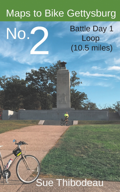
Learn about the Battle of Gettysburg on two wheels, and enjoy the thrill of outdoor, experiential learning.Maps to Bike Gettysburg No. 2: Battle Day 1 Loop is for experienced and recreational cyclists who want to combine learning about the Battle of Gettysburg with a first-hand, visceral experience of the battlefield landscape. On a bike, historical touring is not only more personal, but one can gain a better appreciation for battlefield hills and swales and for distances covered.This book provides color maps and turn-by-turn directions for a safe and educational, 10.5-mile park ride to visit the most famous landmarks of the July 1 battlefield, including McPhersonâÇÖs Ridge, Oak Hill, and BarlowâÇÖs Knoll. Designed for a lightweight ride, this book complements Civil War CyclingâÇÖs more detailed and comprehensive guidebook, Bicycling Gettysburg National Military Park.Part of a new series of Gettysburg mini-books by Civil War Cycling, Maps to Bike Gettysburg No. 2 contains 15 detailed color maps with corresponding bicycle cue tables, 45 color photos, monument GPS points, and micro-histories for learning about the Battle of Gettysburg.áAfter a tour of East Cemetery Hill and McPhersonâÇÖs Ridge, you will ride north along Seminary Ridge to Oak Hill, and then down to BarlowâÇÖs Knoll, through town, and end with a tour of the Confederate and Union battle lines around CulpâÇÖs Hill. 574âÇÖ cumulative gain. Plan for a 3-4 hour ride with frequent stops to appreciate the beautiful landscape and some of the parkâÇÖs 1,300+ monuments.áLike all Civil War Cycling routes through Gettysburg National Military Park, Route 2 provides health and safety tips, identifies one-way roads, and notes the location of bicycle racks, water, restrooms, and picnic areas.